Powered By Blogger

Search This Blog

Popular Posts

Showing posts with label environment. Show all posts

Saturday, May 15, 2021

WORLDS FISRT RENEWABLE(SOLAR) ENERGY SUMMIT

 RENEWABLE ENERGY

First World Solar Technology Summit 

 The first World Solar Technology Summit (WSTS) is being organized by the International Solar Alliance (ISA)

on 8th September, 2020.

 The Federation of Indian Chambers of Commerce and Industry (FICCI), as the convener of ISA Global

Leadership Task Force on Innovation, is working with ISA in organizing the summit.

 The summit will witness the announcement of agreements between ISA and following institutions

1. International Institute of Refrigeration,

2. Global Green Growth Institute

3. National Thermal Power Corporation.

 A tripartite agreement between India‘s Ministry of New and Renewable Energy, the World Bank and the

International Solar Alliance is also set to be inked.

 ISA‘s technology journal, Solar Compass 360 will also be l


World’s Largest Solar Tree


 CSIR- Central Mechanical Engineering Research Institute (CMERI) has developed the World‘s Largest Solar 

Tree and installed it at Durgapur, West Bengal. 

 The installed capacity of the Solar Tree is above 11.5 kWp. 

 There are a total of 35 Solar PV Panels in each tree with a capacity of 330 wp each. 

 It has the annual capacity to generate 12,000-14,000 units of Clean and Green 

Power, West Bengal.

 The inclination of the arms holding the Solar PV Panels are flexible and can be 

adjusted as per requirement, this feature is not available in Roof-Mounted Solar facilities.

 MSMEs who are interested in the solar tree can align their Business Model with PM KUSUM Scheme for 

farmers, for developing a Renewable Energy based Energy Grid.

Friday, May 14, 2021

Agricultural Subsidies & Air Pollution

IMPACT OF Agricultural Subsidies ON Air Pollution 


What is the issue? 

 Our current system of subsidies is a big reason for air pollution.

 So, some changes could be made in the subsidies of the power, fertilizer and procurement fronts.

What is the situation? 

 People in Delhi and Indo-Gangetic Plain are choking due to air pollution.

 As winter dawns, the wind slows, temperatures drop, and suspended particulate matter (PM) accumulates.

 The high pollution in Delhi and its surrounding is due to the congested traffic, dust, construction, waste

burning, etc,

 It gets a top-up from paddy-stubble burning in Punjab, Haryana and Western Uttar Pradesh.

What contributes to air pollution? 

 Agriculture’s contribution to air pollution runs even deeper than what happens between crop seasons.

 Atmospheric ammonia comes from fertiliser use, animal husbandry, and other agricultural practices.

 This combined with emissions from power plants, transportation, and other fossil fuel burning form fine

particles.

 Agriculture is a victim of pollution as well as a perpetrator.

 Particulate matter and ground-level ozone (from industrial, power plant, and transportation emissions among others) cause losses in crop yields.

 Ozone damages plant cells, handicapping photosynthesis, while particulate matter dims the sunlight that

reaches crops.

What is the irony? 

 The irony of agricultural pollution is that taxpayers are essentially paying for it through a system of subsidies.

 These subsidies motivate the very behaviors that drive the agricultural emissions that the taxpayers breathe.

How does subsidy contribute to air pollution? 

 Free power - hence ―free‖ water, pumped from the ground - is a big part of what makes growing rice in these areas attractive.

 Open-ended procurement of paddy, in spite of bulging stocks of grains with the Food Corporation of

India, adds to the incentives.

 Subsidies account for almost 15% of the value of rice being produced in Punjab-Haryana belt.

 Fertiliser, particularly urea in granular form, is highly subsidised.

 Urea is one of the cheapest forms of nitrogen-based fertiliser, but it is also one of the first to release ammonia

into the air.

 This loss of nitrogen leads to a cycle of more and more fertiliser being applied to get the intended benefits for

crops.

What could be done? 

 An important element to correct in the policy matrix is the policy of subsidies on power, fertilisers and

procurement.

 The nature of support to farmers should be shifted from input subsidies to investment subsidies.

 A diversification package, equally contributed by the Centre and states, may be done to reduce agricultural

pollution.

 The approach to diversification has to be demand-led, with a holistic framework of value chain, and not just

focused on production.

 On the fertiliser front, instead of massive subsidisation of urea, the farmers could be given an input subsidy

in cash on per hectare basis.

 Government procurement of paddy from farmers burning stubble in their fields may also be restricted.

 Taken together, these measures could double farmers‘ incomes, promote efficiency in resource use, and reduce

pollution.

 Released norms on NOx Emissions 

 NOx or Oxides of nitrogen are a criteria pollutant emitted on burning coal.

 NOx is harmful, it also triggers the formation of ground level ozone and leads to secondary particulate matter worsening health risks and needs to be controlled.

 Coal-based power plants, besides the transport sector, are a major source of this pollutant.

 There were no limits placed to control emissions of NOx from power plants before 2015.

 The MoEF&CC introduced limits of 300 mg / Nm3.

 Recently Union Ministry of Environment, Forest and Climate Change (MoEF&CC) has relaxed NOx emission

norms.

 It has been relaxed to 450 mg / Nm3, from 300 mg / Nm3, for power stations commissioned between 2003

and 2015.

 The relaxations were brought about as the power sector strongly lobbied watering down the norms, alleging it was not possible to meet the 300 mg / Nm3 standard at all loads.

 Boiler companies assured government that a NOx emission level of 450 mg / Nm3 can be achieved by combustion modification.

 To meet emissions below it would mean installation of slightly expensive pollution control equipment like

selective non-catalytic reactors (SNCR) will be required.

Human Emissions of Nitrous Oxid

 According to recent findings Human emissions of

nitrous oxide (N2O) increased by 30 per cent between

1980 and 2016.

 Its global concentration levels increased from 270 parts

per billion (ppb) in 1750 to 331 ppb in 2018, a jump of

20 per cent.

 The growth has been the quickest in the past five

decades because of human emissions.

 It has also found that a major proportion of the N2O

emissions in the last four decades came from the

agricultural sector, mainly because of the use nitrogen-

based fertilisers.

 Most N2O emissions have come from emergin

Thursday, May 13, 2021

World’s First ‘Energy Island’ to be built by Denmark


World’s First ‘Energy Island


 Denmark, the nation that built the world’s first offshore wind farm, has agreed to an ambitious plan for another global first – an energy island in the North Sea which could eventually be capable of supplying energy to a history-making 10 million homes. The move will create a critical boost to the world’s offshore wind capacity.

The first hub and spoke  scheme will involve building an island 80 kilometres off the Danish coastline to act as the transmission centre for hundreds of wind turbines surrounding it. It is the largest construction project of Danish which is around $34billon

The project is also a potential blueprint for other coastal nations to develop their own green energy sources. “It’s in Danish waters, yes, but it could conceptually be in any other country."

Energy hub for the world

The initial phase for the artificial island is around the size of 18 soccer pitches. Initially, the North Sea hub will be capable of producing 3 gigawatts of electricity, but the plan is to scale up to 10 gigawatts, which is nearly one-and-a-half times Denmark’s current needs.

As well as supplying other European countries with electricity, the goal is to use the new offshore island to produce green hydrogen from seawater, which can also be exported. Large batteries on the island will store surplus electricity for use when demand is high.

Although the Danish government will own a majority stake, private companies will be invited to join a public/private partnership to build the project. Power will be supplied by as many as 600 giant wind turbines, each standing up to 260 metres tall.

DENMARK‟S ARTIFICIAL ENERGY ISLAND PROJECT. IMPORTANT POINTS


◾️ The Danish government approved a plan to build an artificial island in the North Sea as part of its effort to switch to green energy.

◾️An energy island is based on a platform that serves as a hub for electricity generation from surrounding offshore wind farms.

 ◾️The artificial island will be located about 80 km into the North Sea and the majority of it will be owned by the Danish government.

Tuesday, May 11, 2021

ANAMALAI TIGER RESERVE

ANAMALAI TIGER RESERVE


Anamalai Tiger Reserve (ATR) is located on the southern side of the South Western Ghat 

landscape. It is surrounded by Parambikulum Tiger Reserve on the East, Chinnar Wildlife 

Sanctuary and Eravikulum National Park on the South Western side. The reserve is also surrounded 

by Nenmara, Vazhachal, Malayattur and Marayur reserved forests of Kerala. The Kariyan shola, 

Grass hills and Manjampatti of Anamalai Tiger Reserve has been identified as a world heritage site 

by the UNESCO.

Anamalai Tiger Reserve was declared as a Tiger reserve in the year 2007. There are two Divisions 

and six ranges in this Reserve. The ranges found in this reserve include Amaravathi and Udumalpet 

falling in Thiruppur Division and Pollachi, Ulandy, Valparai and Manamboli in Pollachi Division.

Area of the Tiger Reserve

Core/critical tiger Habitat : 958.59 sq km

Buffer/Peripheral Area : 521.28 sq km

Total : 1479.87 sq km

Location

Latitudes : 10O 13.2’ N to 10 O 33.3’N

Longitudes : 76 O 49.3’ E to 77 O 21.4’ E

Habitat Attributes

Flora

Around 2500 species of angiosperms are found in the Anamalai Tiger Reserve, with several species 

of Balsam, Crotalaria, Orchids and Kurinchi. The reserve is rich in wild relatives of cultivated 

species like mango, jackfruit, wild plantain (Musa species), ginger (Zingiber officinale), turmeric 

(Curcuma longa), pepper (Piper longum), cardamom, solaipuli, nutmeg, cinnamom, amla 

(Phillanthus emblicus), jasmine (Jasminum species), drumstick, yams, rice, strawberries and wild

Fauna 

The reserve supports several species of endangered wild animals. There are 70 species of fishes, 

more than 70 species of amphibians, 120 species of reptiles, 300 species of birds and 80 species of 

mammals. The important mammals include: Asiatic elephant (Elephas maximus), Sambar (Rusa 

unicolor), Spotted deer (Axis axis) Barking deer (Muntiacus muntjac), Mouse deer (Tragulus 

nigricans), Gaur (Bos garus), Nilgiri tahr (Hemitragus hylocrius), Lion Tailed Macaque (Macaca 

silenus), Nilgiri langur (Trchypithecus johnii) and Common langur (Semnopithecus entellus). Other

common wild animals include: Wild pig (Sus scrofa) and Sloth bear (Melursus ursinus).

In general, the wild animals of the reserve include: Jackal (Canis aureus), Wild dog (Cuon alpines), 

Indian fox (Vulpes bengalensis), Tiger (Panthera tigirs), Leopard (Panthera pardus), Jungle cat 

(Felis chaus), Leopard cat (Prionailurus bengalensis), Smooth coated otter (Lutrogale 

perspicillata), Small clawed otter (Aonyx cinerea), Nilgiri marten (Martes gwatkinsii), Small Indian

civet (Viverricula indica), common Palm civet (Paradoxurus hermaphrodites), Brown palm civet 

(Paradoxurus jerdoni), Grey mangoose (Herpestes edwardsii), Ruddy mangoose (Herpestes 

smithii), Indian Brown mangoose (Herpestes fuscus), Stripe-necked mangoose (Herpestes 

vitticollis), Indian pangolin (Manis crassicaudata), Black naped hare (Lepus nigricollis), several 

species of rodents and bats. 

Tiger Status

The reserve has a good presence of tigers and co-predators.

Core

Camera trapping in 698 sq.km. of the tiger reserve have shown the presence of a minimum of 15 

tigers in the sampled area.

Buffer

The Buffer area of Anamalai Tiger Reserve is a 10 kilometer belt of revenue villages and hamlets, 

along the Northern boundary, adjoining the plains of Pollachi and Udumalpet taluks. In the East, it 

shares a common boundary, including a 5 kilometer belt falling in two adjoining divisions, viz. 

Kodaikanal and Dindigul.

The interstate boundaries from West, South and East are shared with the Nemmara Forest Division, 

Parambikulam Tiger Reserve, Vazhachal Forest Division, Malayatoor Forest Division, Munnar 

Forest Division, Eravikulam National Park and Chinnar Wildlife Sanctuary. The Parambikulum 

Tiger Reserve is within a radius of 10 kilometers of the reserve and is contiguous.

Wildlife Corridors

There are several wildlife corridors which include: Navamalai near monkey falls, Punachi in 

Valparai range, Waterfall, Siluvaimedu, Nadu Ar, Sethumadai–Nenmara and 9/6–Chinnar check 

post. Wild animals like elephant, gaur, tiger, leopard and wild dog use these corridors for their 

seasonal movement within the reserve, and also between the reserv


IMPORTANT POINTS TO REMEMBER

●Anamalai Tiger Reserve is tropical jungle, shola forest and grassland.

●It is spilled over the Western Ghats into Kerala between Kodaikanal and Coimbatore. 

●Threatened species of mammals in the sanctuary include:

1)Endangered Bengal tiger, Indian elephant, Indian leopard

Nilgiri tahr and lion-tailed macaque,

2)Vulnerable brown mongoose, gaur, Malabar spiny dormouse, Nilgiri langur, rusty-spotted cat, sambar deer, sloth bear and smooth-coated otter,

3)near threatened Indian giant squirrel, Indian leopard and Indian pangolin.

●Tropical wet evergreen forest is found at an altitude of 600 m to 1,600 m.

●Tropical montane forests occur at higher elevations and are interspersed with montane grasslands, forming the shola-grassland complex. 


Friday, May 7, 2021

SATYABHAMA (Science and Technology Yojana for Atmanirbhar Bharat in Mining Advancement)

 SATYABHAMA (Science and Technology Yojana for Atmanirbhar Bharat in Mining Advancement)


The Ministry of Mines has launched a portal "SATYABHAMA (Science and Technology Yojana for Atmanirbhar Bharat in Mining Advancement)" with an aim to promote research and development in the mining and minerals sector

Ministry of Mines, Govt. of India provides funds to Academic institutions, universities, national institutes and R&D institutions recognized with the Department of Scientific and Industrial Research, Government of India for implementing R&D projects under Science and Technology Programme Scheme of Ministry of Mines with the vision to promote research in applied geosciences, mineral exploration, mining and allied areas, mineral processing, optimum utilization and conservation of the mineral resources of the country, for the benefit of the nation and its people.


The broad thrust areas for supporting Research in Mining are given below:

Prospecting / exploration for strategic, rare and rare earth minerals.
• Development of new technology for mineral exploration and mining on land and deep sea to locate and exploit new mineral resources.
• Research in mining methods. This includes rock mechanics, mine designing, mining equipments, energy conservation, environmental protection and mine safety.
• Improve efficiency in process, operations, recovery of by-products and reduction in specification and consumption norms.
• Research in metallurgy and mineral beneficiation techniques to utilize lower grade and finer size ores.
• Extraction of value added products from mine waste, plant tailings etc.
• Development of new alloys and metal related products, etc.
• Evolve low capital and energy saving processing systems.
• Production of materials of high purity.
• Cooperative research among organizations associated with the mineral sector.

Thursday, May 6, 2021

ZABO RAIN WATER HARVESTING

 Zabo WATER conservation


The zabo (the word means 'impounding run-off') system is practiced in Nagaland in north-eastern India. Also known as the ruza system, it combines water conservation with forestry, agriculture and animal care.
Villages such as Kikruma, where zabos are found even today, are located on a high ridge. Though drinking water is a major problem, the area receives high rainfall. The rain falls on a patch of protected forest on the hilltop; as the water runs off along the slope, it passes through various terraces. The water is collected in pond-like structures in the middle terraces; below are cattle yards, and towards the foot of the hill are paddy fields, where the run-off 

It is an ingenious method of catching rainwater from running off the mountains practised in Kikruma in Nagaland. It involves the preservation of forests on the hilltops as they are the catchment for the water. At the next level are the ponds dug out to hold rainwater, which is brought there through small channels. The water is passed through cattle yards and carries the dung and urine of the animals to the fields below – perfect to meet the nutritional needs of the soil. The paddy fields are also used to rear fish, yielding about 50-60 kilogrammes of fish per hectare as an additional output. A huge variety of medicinal plants and herbs grow on the embankments of the ponds. The ponds are constructed to distribute water evenly. Inlet channels are dug to carry water from one pond to the next. The zabo system has not been replicated elsewhere.

Wednesday, May 5, 2021

BURMESE ROOFED TURTLES


Burmese roofed turtle


The Burmese roofed turtle (Batagur trivittata), a river turtle native to Burma, now known as Myanmar and other rivers in Asia was thought to be extinct about 20 years ago. Conservation efforts for the species were launched after several individual turtles were rediscovered  including some that have been released back into the wild.

The Burmese roofed turtle (Batagur trivittata) is known for its distinctive smiley mouth, googly eyes, and upturned snout. The female of the species is a more muted color and significantly larger than the males, while the smaller males are light-colored, especially during mating season when they can show off some bright greenish-blue and yellow coloration.

The species was once thought functionally extinct in the wild until a shell from a recently killed turtle was discovered in 2001 near a village on the Dokhtawady River. Following that discovery, live specimens were discovered in a wildlife market in Hong Kong and in ponds in Mandalay. These same turtles formed the backbone for the captive breeding effort that has resulted in some 1,000 turtles.

IMPORTANT POINTS


Species in focus: Burmese roofed turtles (Batagur trivittata)

Population: Less than 10 individuals globally

Current status, according to the IUCN Red List: Critically endangered

Population trend: Decreasing

Myanmar’s Burmese roofed turtle, a highly endangered species that is making a slow comeback, caught worldwide attention this year.

These freshwater turtles are considered one of the most endangered turtle species in the world-they have all but disappeared from their entire geographical range.

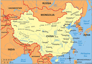
CHINA'S, Taklamakan Desert


TAKLAMAKAN DESERT


Takla Makan Desert is China's largest desert, situated in the middle of the largest Basin, Tarim in Xinjiang Province. This is reputed to be the world's second largest shifting-sand desert covering an area of over 33, 700 square kilometers (over 13,000 square miles).

In Uigur language, Takla Makan means 'you can get into it but can never get out' and the desert has another name 'the Sea of Death'. The desert is regarded as being very powerful among the people; no wonder the name connotes fear. But there was an interesting legend about its origin. It was said that there was a Supernatural Being, who saw the hardship being faced by the people in this area and thought that he could help them by using the two magic objects in his possession namely the golden axe and the golden key. He gave his golden axe to the Kazakh, so they split the mountain Altai and diverted water from the mountains to the fields. The Supernatural Being planned to give the golden key to the Uigur so that they could open the door of the treasure-house of the Tarim Basin, but unfortunately his youngest daughter lost the key. This angered him so much that he held her a captive in the Tarim Basin and thus the Takla Makan Desert was formed.

Continuous sand dunes in this large Takla Makan Desert are usually over 100 meters high (over 109 yards) and some are even higher than 300 meters (about 328 yards). Because of the wind, the sand dunes are always moving forward and statistics suggests that each year they move about 150 meters (about 164 yards), which seriously threatens the existence of oasis and the survival of the local populace. For the past 50 years, the Chinese Government has made great effort to plant trees to reduce the encroachments of the sandstorms. With the help of experts, local people planted diversiform-leaved poplars, rose-willows, pomegranate trees, mulberries and built windbreak belts as corrective measures and in some places, people even cultivate corn. There is an improvement in the living condition of the local people, thanks to the increase in vegetation. Now there are over 80 species of birds' resident in the interior desert and the precipitation is increasing as well.

 TaklaMakan Desert is also rich in natural resources, buried under it vast expanse are resources such as groundwater, oil and oil gas. During the oilfields' opening up, people encountered the problems of transportation. Thus the idea of building a highway came to people's mind. In the year 1995, a desert-road of 522 kilometers (more than 324 miles) was completed and opened to traffic. Construction work has commenced on the second desert-road in June, 2005 and it is to be completed by the end of 2007.

Tuesday, May 4, 2021

INDIAN PANGOLIN. IMPORTANT FACTS


INDIAN PANGOLIN. 


IUCN Status: Endangered (A3d+4d)

Distribution: Bangladesh, India, Nepal, Pakistan and Sri Lanka.

Distinguishing characteristics: The Indian pangolin has the most western distribution in Asia with a range extending into two regions of Pakistan. It can be distinguished from other Asian pangolins by the size of its scales, which reach a considerably larger size than scales of the Chinese, Sunda and Philippine pangolins. Like the Chinese pangolin it has a principally fossorial as opposed to arboreal lifestyle and noticeably larger front claws than the Sunda and Philippine pangolins.

Reproduction: The Indian pangolin usually has one offspring, though two have been reported, after a gestation period of 65-70 days, which is much shorter than for other species of pangolin.

Facts: Although normally shy, Indian pangolins are reported to wander into villages and have been known to dig through concrete and into houses.
IMPORTANT POINTS
In shorts.


Indian pangolin
●Indian Pangolin, also called thick-tailed pangolin and scaly anteater is a pangolin native to the Indian subcontinent.
● Like other pangolins, it has large, overlapping scales on its body which act as armour. 
●It can also curl itself into a ball as self-defence against predators such as the tiger. 
●Indian Pangolin is widely distributed in India, except the arid region, high Himalayas and the North-East.
● It can be found at elevation up to 2500 m. The species also occurs in Bangladesh, Pakistan, Nepal and Sri Lanka.
●IUCN has classified the Indian pangolin as Endangered.
●Listed in Schedule I of Wildlife (Protection) Act, 1972.